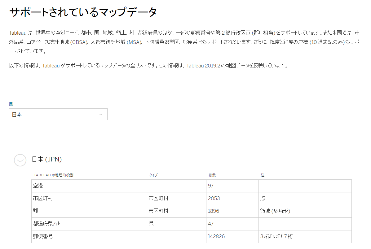
Tableauのサポートするマップデータ
以下サポートマトリクスに掲載の通り、日本の都道府県・市区町村はポリゴンとして地図上にマップすることが可能です
https://www.tableau.com/ja-jp/mapdata
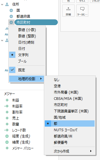
市区町村ポリゴンをマップする方法
- 上記マトリクスをよく見ると、日本の市区町村は地理的役割として「郡」(英語版のCounty)を割り当てる必要があります
- v2019.3以前のバージョンのサンプルスーパーストアでは、住所:市区町村フィールドの地理的役割として「市区町村」が誤って割り当てされていたため、市区町村はポリゴン表示できないと誤解がありましたが、v2018.2よりすべての市区町村ポリゴンがサポートされています(*1)
- v2019.3のサンプルスーパーストアでは、住所:市区町村フィールドの地理的役割が「郡」に修正されました

(*1) https://www.tableau.com/ja-jp/2018-2-features#feature-87791