PostgreSQLでgeometry(緯度経度)として管理しているデータをGoogleDataPotalのMapとして作成する方法をまとめる。
やりたいこと
- DBデータをGoogleMapに反映させる
- 拡大縮小に併せて表示領域も変化する
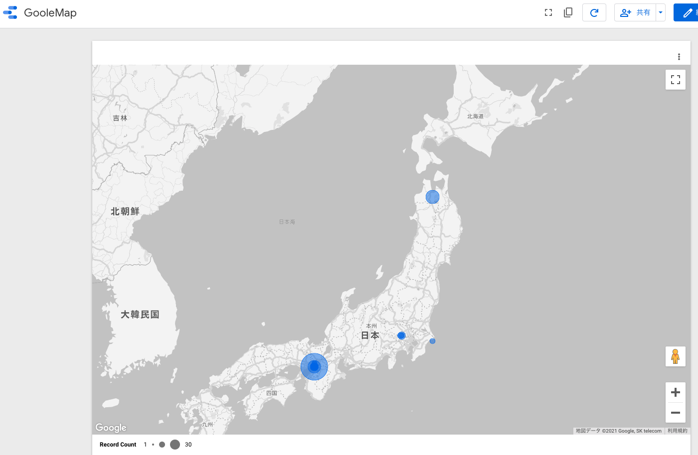
完成イメージ↓
準備:GoogleDataPotalで扱う「緯度経度」形式の変換
DBではgeometoryとして管理
select geopoint from data;
=> geopoint: "0101000020E6100000F42FEEAB1751444031F9556F03976140"
GoogleDataPotalでの「緯度,経度」の形式にする
select concat(ST_X(geopoint), ',', ST_Y(geopoint)) AS geo from data;
=> geo: "40.6335349,140.7191693"
GoogleDataPotalのデータソースで緯度経度として取り込む
- 上記の形式変換が必要なので、「Custom Query」としてSQLを書いて取り込む
- カラムの種別を「緯度、経度」に設定する(画像)

GooleDataPotalでマップを作成
- グラフ->GoogleMap->「バブルマップ」を選択
- 下の画像を参考に情報を設定

最後に
- ざっと漁った限りだと、緯度経度の形式とか書いてなくて手探りで試したので共有しました。
- 他のMapとかアメリカだと州ごと設定できるけど、日本含め他の国は対応してなさそう。