7
11

Delete article

Deleted articles cannot be recovered.

Draft of this article would be also deleted.

Are you sure you want to delete this article?

More than 5 years have passed since last update.

RでGoogle Mapsを使う

Posted at

Google Mapsから取得した静的な地図の画像上にRからプロットを重ねる方法を紹介します。

以下のライブラリを使います。

RgoogleMaps

GoogleMapsSample.R
#install.packages("RgoogleMaps",dep = TRUE) # 初めての時はライブラリをダウンロードする
library(RgoogleMaps)

zoom<-14 #地図の倍率指定。大きいほど地図が拡大されます
map = GetMap(c(lat = 35.681382, lon = 139.766084), # 地図の中心点を指定。緯度経度
             zoom=zoom, # 地図の倍率指定
             sensor="false", 
             hl="ja" # 地図表示の言語を指定。
             )

PlotOnStaticMap(map) # 地図の描画


# すでに描画したMapに点を重ねる
PlotOnStaticMap(map,
                lat=35.681382,  # 点を重ねる緯度
                lon=139.766084, # 点を重ねる経度
                pch=19, 
                cex=2,
                col = rgb(0, 0, 1, alpha=1),
                add=TRUE # 描画済の地図に点を重ねるオプションを有効化
                )
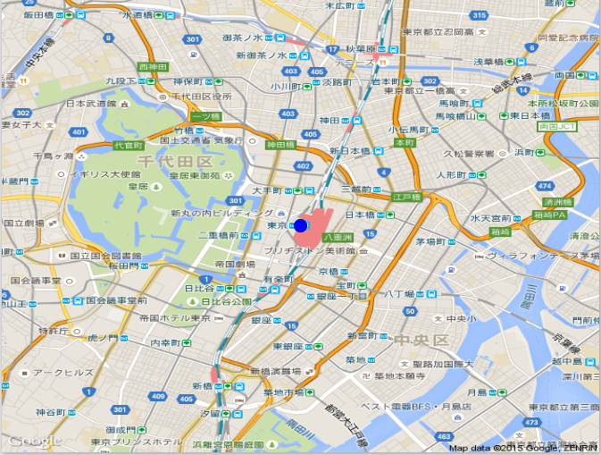

以下のような画像を取得できます。

  • 画像のダウンロードは、RStudioを使っていればポチポチすればできます。
  • 今回は東京駅が中心の地図を出してみました。
  • 今回は、1ポイントのみの描画ですが、緯度経度を外部ファイルに書き出し、それを読み込んでLoopで回すことで複数点の描画もできます。(300ポイントぐらいはやってみました。)
    東京駅.PNG
7
11
0

Register as a new user and use Qiita more conveniently

  1. You get articles that match your needs
  2. You can efficiently read back useful information
  3. You can use dark theme
What you can do with signing up
7
11

Delete article

Deleted articles cannot be recovered.

Draft of this article would be also deleted.

Are you sure you want to delete this article?