Postgres で Function 定義
landmark テーブルで、指定した中心点と半径に含まれるレコードを、近い順に並べ抽出する。
-
landmarksテーブルを作成 -
array_to_geography()Function を作成する。- array ([longitude, latitude])を
geographyに変換する。
- array ([longitude, latitude])を
-
geo_landmarks()Function では geography の値を使用し、パラメーターの円(中心点と半径)に含まれる landmark を円の中心点より近い順に並べて返す。
create table landmarks (
    id uuid default gen_random_uuid(),
    name text not null,
    description text,
    point double precision[],
    geopoint geography(point, 4326),
    location jsonb not null default '{}',
    primary key (id)
);

create or replace function array_to_geography() returns trigger as $$
begin
    new.geopoint = st_setsrid(st_point(new.point[1], new.point[2]), 4326)::geography;
    new.location = json_build_object('longitude', new.point[1], 'latitude', new.point[2]);
    return new;
end;
$$ language plpgsql;

create trigger trigger_array_to_geography
before insert or update on landmarks
for each row execute procedure array_to_geography();

create or replace function public.geo_landmarks(
    latitude double precision,
    longitude double precision,
    radius integer
) returns setof public.landmarks as $$

    select
        id,
        name,
        description,
        point,
        geopoint,
        case
            when point is null then '{}'::jsonb
            else json_build_object(
                'longitude',
                point[1],
                'latitude',
                point[2],
                'distance',
                st_distance(st_point(longitude, latitude)::geography, geopoint)
            )::jsonb
        end as location
    from
        landmarks
    where
        st_dwithin(geopoint, st_point(longitude, latitude)::geography, radius)
    order by
        st_distance(st_point(longitude, latitude)::geography, geopoint),
        name asc
    ;

$$ language sql stable;
よくよく見ると、それ必要?といった所もあるが大目に見る。
上記定義と Hasura で API を試す
Hasura を起動する
git clone https://github.com/high-u/tryout-hasura.git
cd tryout-hasura/postgis

docker compose up -d
しばし待つ...しばし待つ...
ブラウザで Hasura を開く
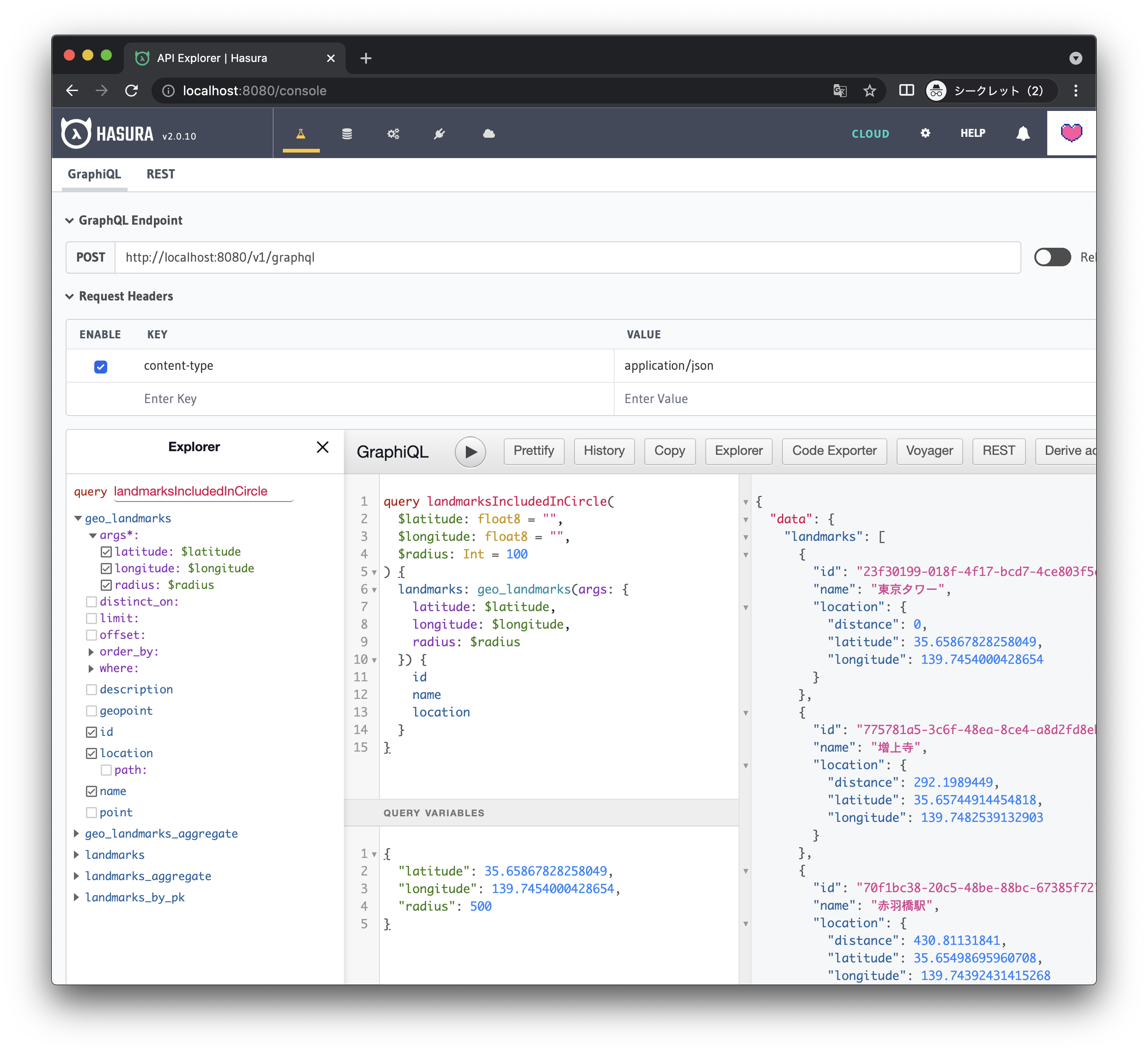
GraphQL に
query landmarksIncludedInCircle(
  $latitude: float8 = "",
  $longitude: float8 = "",
  $radius: Int = 100
) {
  landmarks: geo_landmarks(args: {
    latitude: $latitude,
    longitude: $longitude,
    radius: $radius
  }) {
    id
    name
    location
  }
}
QUERY VARIABLES に
{
  "latitude": 35.65867828258049,
  "longitude": 139.7454000428654,
  "radius": 500
}

を押すと API が実行されレスポンスが表示される。
そもそもどんなデータが登録されているかは、ここで確認。
後始末
docker compose down -v
あとがき
大量のアクセスをさばく必要がある場合には要注意だが、PostGIS を利用した距離計算付きの API が GraphQL としてあっという間に構築できることに感動した。
謝辞
下記記事に多くを学ばせていただきました。