記事一覧
Swift MkMapViewで地図アプリ作成してみた(記事一覧)
地図表示タイプを切り替えるボタンを配置する
UIButtonの変数を定義する。
ViewController.swift:UIButtonの変数を定義する
class ViewController:   UIViewController,
                        CLLocationManagerDelegate,
                        UIGestureRecognizerDelegate {

    var mapViewType: UIButton!
コード上からボタンを配置する。
ViewController.swift:ボタンを配置
        // 地図表示タイプを切り替えるボタンを配置する
        mapViewType = UIButton(type: UIButton.ButtonType.detailDisclosure)
        mapViewType.frame = CGRect(x:width - 50, y:60, width:40, height:40)
        mapViewType.layer.backgroundColor = UIColor(white: 1, alpha: 0.8).cgColor // 背景色
        mapViewType.layer.borderWidth = 0.5 // 枠線の幅
        mapViewType.layer.borderColor = UIColor.blue.cgColor // 枠線の色
        self.view.addSubview(mapViewType)
タッチダウンを検出して地図の表示タイプを切り替える
タッチダウン時にCallする関数を定義する。
ViewController.swift:タッチダウン時にCallする関数
    // 地図の表示タイプを切り替える
    @objc internal func mapViewTypeBtnThouchDown(_ sender: Any) {
        switch mapView.mapType {
        case .standard:         // 標準の地図
            mapView.mapType = .satellite
            break
        case .satellite:        // 航空写真
            mapView.mapType = .hybrid
            break
        case .hybrid:           // 標準の地図+航空写真
            mapView.mapType = .satelliteFlyover
            break
        case .satelliteFlyover: // 3D航空写真
            mapView.mapType = .hybridFlyover
            break
        case .hybridFlyover:    // 3D標準の地図+航空写真
            mapView.mapType = .mutedStandard
            break
        case .mutedStandard:    // 地図よりもデータを強調
            mapView.mapType = .standard
            break
        }
    }
タッチダウン時に作成した関数をCallする。
ViewController.swift:タッチダウン時に作成した関数をCall
mapViewType.addTarget(self, action: #selector(ViewController.mapViewTypeBtnThouchDown(_:)), for: .touchDown)
PCシミュレータで実行した結果は以下の通り。
| mapType | 説明 | 画像 |
|---|---|---|
| .standard | 標準の地図 | 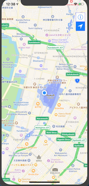 |
| .satellite | 航空写真 | 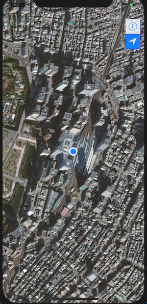 |
| .hybrid | 標準の地図+航空写真 | 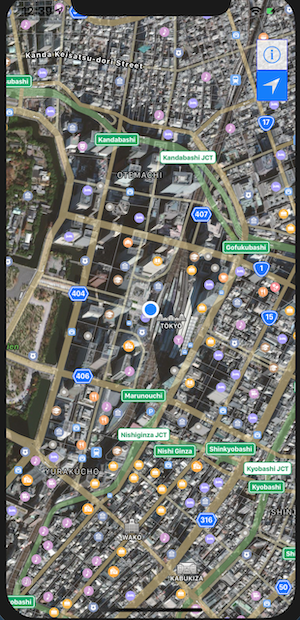 |
| .satelliteFlyover | 3D航空写真 | 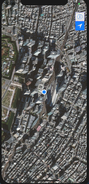 |
| .hybridFlyover | 3D標準の地図+航空写真 | 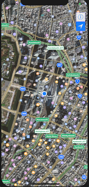 |
| .mutedStandard | 地図よりもデータを強調 | 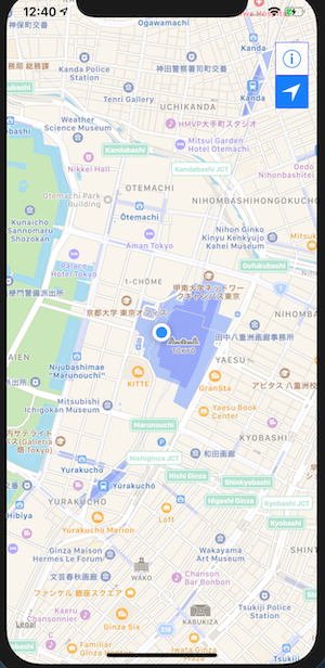 |