参考
osmnx/osmnxTest.py
https://github.com/smnra/osmnx/blob/master/osmnxTest.py
get_city_shp.py
# !/usr/bin/python3
# -*- coding: utf-8 -*-

import osmnx as ox
import matplotlib.pyplot as plt
import sys

args = sys.argv
argc = len(args) # 引数の個数

if (argc != 2):   # 引数がない場合
    print ('./get_city_shp.py 目的地の名称')
    quit()


cityName = args[1] #'HigashiOsaka','tokyo,Japan'
city = ox.gdf_from_place(cityName)
city.plot()

ox.save_gdf_shapefile(city,cityName,'./data') #dataフォルダに保存

plt.show()
$ ./get_city_shp.py HigashiOsaka
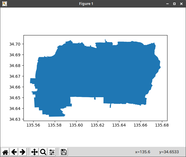
実行したフォルダのdataフォルダにHigashiOsakaフォルダが作成され、
HigashiOsaka.cpg HigashiOsaka.prj HigashiOsaka.shx
HigashiOsaka.dbf HigashiOsaka.shp
が保存される。
引数cityNameの例
HigashiOsaka
Tokyo,Japan
雁塔区,西安,中国
"Manhattan, New York, USA"
引数にスペースが含まれる場合は、コーテーションマークで括る
上記で取得したシェープファイルを利用する
# !/usr/bin/python3
# coding: UTF-8
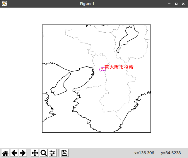
from mpl_toolkits.basemap import Basemap
import matplotlib.pyplot as plt
import japan_border2 as jb2 #都府県境界線
font = {'family': 'IPAGothic'} # 日本語Fontを指定
lon1 = 135.50
lat1 = 34.5
lon2 = 1.0
lat2 = 1.0
map = Basemap(llcrnrlon=lon1-lon2,llcrnrlat=lat1-lat2,urcrnrlon=lon1+lon2,urcrnrlat=lat1+lat2,resolution='i',projection='cyl')
map.drawcoastlines() #海岸線
jb2.prefectural_bound(map = map) #都府県境界線
map.readshapefile('/home/ty/python/map/OSMnx/data/HigashiOsaka/HigashiOsaka', 'counties', color ='m')
lon = 135.6009
lat = 34.6793
plt.plot(lon, lat, 'ro', markersize=2, color='red')
plt.text(lon, lat, " 東大阪市役所", fontsize=12, color='red', **font)
print(map.counties)
plt.show()