概要
Google Earth Engineで、標高、計算してみた。
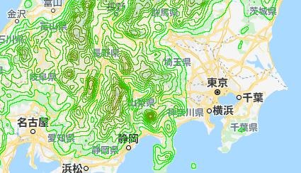
写真
サンプルコード
var srtm = ee.Image('USGS/SRTMGL1_003');
var pt = ee.Geometry.Point(139.7978, 35.6028);
var lines = ee.List.sequence(0, 4000, 200);
var contourlines = lines.map(function(line) {
	var mycontour = srtm.convolve(ee.Kernel.gaussian(5, 3)).subtract(ee.Image.constant(line)).zeroCrossing().multiply(ee.Image.constant(line)).toFloat();
	return mycontour.mask(mycontour);
});
contourlines = ee.ImageCollection(contourlines).mosaic();
Map.addLayer(contourlines, {
	min: 0,
	max: 5000,
	palette: ['00ff00', 'ff0000']
}, 'contours');
Map.centerObject(pt, 7);
以上。