概要
- Python 用ライブラリの staticmap を使って OpenStreetMap や地理院地図の画像を取得する
今回の環境
- macOS Catalina + Python 3.9.0 + staticmap 0.5.4
staticmap のインストール
staticmap パッケージをインストールする。
$ pip install staticmap
依存ライブラリとして Pillow と requests もインストールされる。
staticmap デフォルトの地図画像を取得する
ソースコード。
from staticmap import StaticMap

# 地図オブジェクトを生成
# 画像の横幅(ピクセル)と画像の縦幅(ピクセル)を指定
map = StaticMap(800, 600)

# 地図を描画した Pillow の PIL.Image オブジェクトを取得
# ズームレベルと経度・緯度を指定
image = map.render(zoom=17, center=[136.882090, 35.170560])

# 地図画像を保存
image.save('komoot.png')
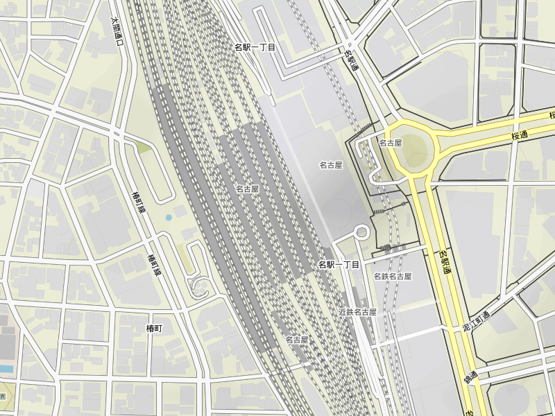
実行結果。
OpenStreetMap の地図画像を取得する
ソースコード。
from staticmap import StaticMap

# 地図オブジェクトを生成
# 画像の横幅と縦幅と OpenStreetMap 標準タイルレイヤーのタイルURLを指定
map = StaticMap(800, 600, url_template='http://a.tile.openstreetmap.org/{z}/{x}/{y}.png')

# 地図を描画した Pillow の PIL.Image オブジェクトを取得
# ズームレベルと経度・緯度を指定
image = map.render(zoom=17, center=[136.882090, 35.170560])

# 地図画像を保存
image.save('osm.png')
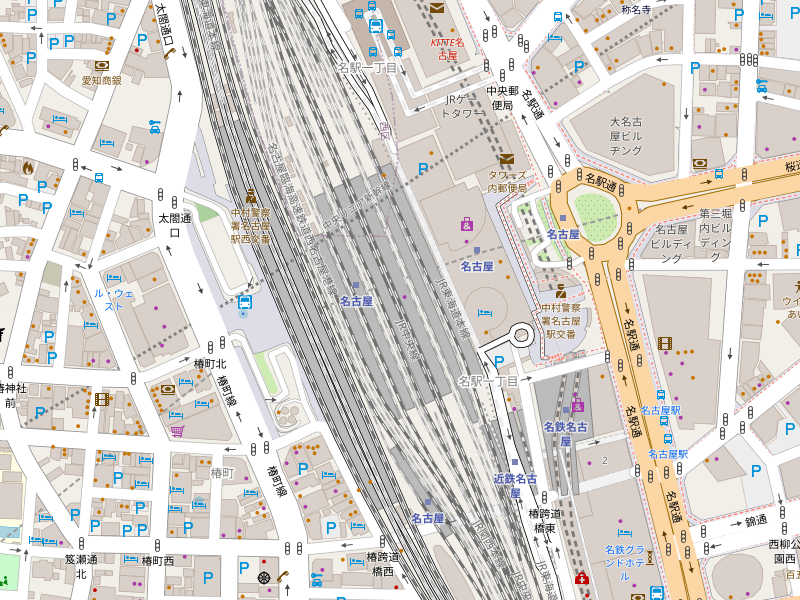
実行結果。
地理院地図の地図画像を取得する
ソースコード。
from staticmap import StaticMap

# 地図オブジェクトを生成
# 画像の横幅と縦幅と国土地理院の地理院タイルURLを指定
map = StaticMap(800, 600, url_template='https://cyberjapandata.gsi.go.jp/xyz/std/{z}/{x}/{y}.png')

# 地図を描画した Pillow の PIL.Image オブジェクトを取得
# ズームレベルと経度・緯度のリストを指定
image = map.render(zoom=14, center=[136.882090, 35.170560])

# 地図画像を保存
image.save('chiriin.png')
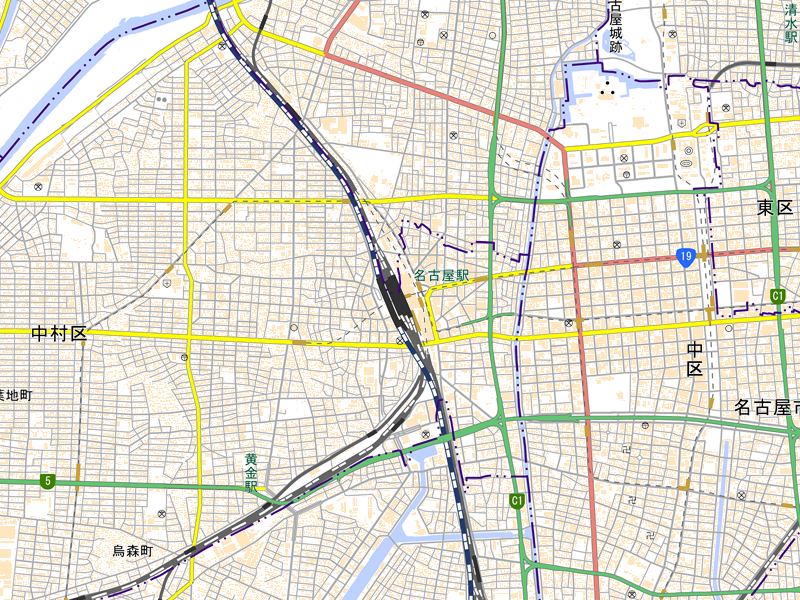
実行結果。
参考資料
- GitHub - komoot/staticmap: A small, python-based library for creating map images with lines, markers and polygons.
- Tiles - OpenStreetMap Wiki
- Zoom levels - OpenStreetMap Wiki
- Tile Usage Policy (OSMF Operations Working Group)
- 地理院地図|地理院タイルについて
- 地理院地図|地理院タイル一覧
- Image Module — Pillow (PIL Fork) 8.0.1 documentation