こんにちは。
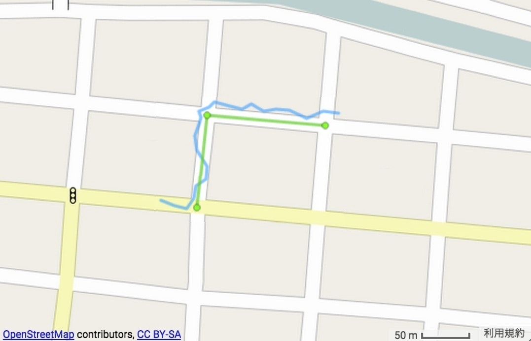
mongodb に OpenStreetMap データを取り込んだので(goosm利用)、応用として、道路に沿って移動した「経緯度点列データ」(下記で青色)を与えた時、その道路(緑色)を特定する問題を考えてみました。geojson形式で書き出しています。
ただし、OpenStreetMap の way データ (highway) は、両端に vertex を持つ単純な edge (線分)である必要があります。
# !/usr/bin/env python
# -*- coding: utf-8 -*-

from __future__ import print_function
import simplejson
import textwrap
from pymongo import MongoClient

client = MongoClient('localhost')

def queryNear(coord, radius):
    return ({"geometry": {"$near": {"$maxDistance": radius, "$geometry": {"type": "Point", "coordinates": coord}}}}, {"_id": 1, "geometry.coordinates": 1, "nodes": 1})

def printgeojson(type, coordinates):
    fmtstr = """\
    {
    "type": "Feature",
    "geometry": {"type": %s, "coordinates": %s},
    "properties": {}
    }"""
    fmtstr = textwrap.dedent(fmtstr)
    print(fmtstr % (type, coordinates), end='')
    return 0

def printNodes(tracks):
    nodes = []
    colnodes = client['osm_nodes']['data']
    prepend = ''
    for coord in tracks:
        results = colnodes.find(*queryNear(coord, radius))
        for r in results:
            if r['_id'] not in nodes:
                nodes.append(r['_id'])
                print(prepend, end='')
                printgeojson("Point", r['geometry']['coordinates'])
                prepend = ',\n'
    return nodes

def printEdges(tracks, nodes):
    edges = []
    coledges = client['osm_edges']['data']
    prepend = ''
    for coord in tracks:
        results = coledges.find(*queryNear(coord, radius))
        for r in results:
            if r['_id'] not in edges and set(r['nodes']).issubset(nodes):
                edges.append(r['_id'])
                print(prepend, end='')
                printgeojson("LineString", r['geometry']['coordinates'])
                prepend = ',\n'
    return edges

def main():
    radius = 30.0
    tracks = [[lon0, lat0], [lon1, lat1], ...] # <== 経緯度点列データを与える
    nodes = printNodes(tracks, radius)
    edges = printEdges(tracks, radius, nodes)
    exit(0)

if __name__ == '__main__':
    main()