iPhoneで撮影した写真にはGPS情報が含まれます。このGPS情報を解析して、QGIS上にポイントとして落としてみます。使用するのはPILモジュールとOSモジュールを使用します。
CSVで出力したい場合はCSVモジュールも必要です。
写真メタデータ解析用の関数を作成
from PIL import Image
from PIL.ExifTags import TAGS

def get_exif(fn):
    ret = {}
    i = Image.open(fn)
    info = i._getexif()
    for tag, value in info.items():
        decoded = TAGS.get(tag, tag)
        ret[decoded] = value
    return ret
関数にファイルを投げ込むとディクショナリにメタデータが格納されます。使い方は↓
my_image = 'hogehoge.jpg'
metadata = get_exif(my_image)
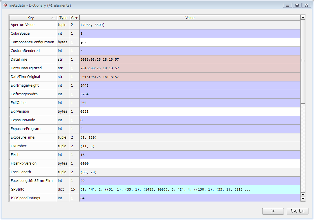
メタデータの中身は色々です。撮影した時間や機種名、その他種々。下の画像はPythonのエディタ(Spyder)のValiable exploreで中身を確認した様子です。
ディクショナリ項目GPSInfoの中にGPSの緯度経度情報が入っています。要素1は南北区分、要素2は緯度(度分秒)、要素3は東西区分、要素4は経度(度分秒)です。
In [1] print(metadata['GPSInfo'])
Out[1] {1: 'N', 2: ((31, 1), (35, 1), (1485, 100)), 3: 'E', 4: ((130, 1), (33, 1), (2132, 100)), 5: 0, 6: (11717, 787), 7: ((9, 1), (13, 1), (5680, 100)), 12: 'K', 13: (0, 1), 16: 'T', 17: (23003, 112), 23: 'T', 24: (23003, 112), 29: '2016:08:25', 31: (5, 1)}
度分秒単位はGISに投げ込むときに面倒くさいので、これを度単位に書き換えます。計算方法は以下の通り。
lon = int(metadata['GPSInfo'][4][0][0]) +
      float(metadata['GPSInfo'][4][1][0]) /60 +
      (float(metadata['GPSInfo'][4][2][0])/float(metadata['GPSInfo'][4][2][1])) /3600
lat = int(metadata['GPSInfo'][2][0][0]) +
      float(metadata['GPSInfo'][2][1][0]) /60 +
      (float(metadata['GPSInfo'][2][2][0])/float(metadata['GPSInfo'][2][2][1])) /3600
対象ファイルが一つの場合は上述のやり方で問題無いですが、複数ファイルを扱いたいのが世の常です。なので以下の様なスクリプトを書きました。
import csv
import os

FileList = os.listdir()
WriteFile = open('photo_gps_point.csv','w')
writer = csv.writer(WriteFile, lineterminator='\n')

for pf in FileList:
    metadata = get_exif(pf)

    csvline = []
    csvline.append(pf)
    csvline.append(metadata['Model'])

    if 'GPSInfo' in metadata.keys():
        csvline.append(
         int(metadata['GPSInfo'][4][0][0]) +
         float(metadata['GPSInfo'][4][1][0]) /60 +
         (float(metadata['GPSInfo'][4][2][0])/float(metadata['GPSInfo'][4][2][1])) /3600)
        csvline.append(
         int(metadata['GPSInfo'][2][0][0]) +
         float(metadata['GPSInfo'][2][1][0]) /60 +
         (float(metadata['GPSInfo'][2][2][0])/float(metadata['GPSInfo'][2][2][1])) /3600)
        writer.writerow(csvline)
    else:
        pass
WriteFile.close()
これで度単位緯度経度のCSVファイル(photo_gps_point.csv)が作成されました。
上述のコードでは作業の都合で撮影した機種名(Model)を入れていますが、これは無くても問題ありません。他に必要な項目があれば置き換えてもOKです。
